St. Louis Crime Data Explorer
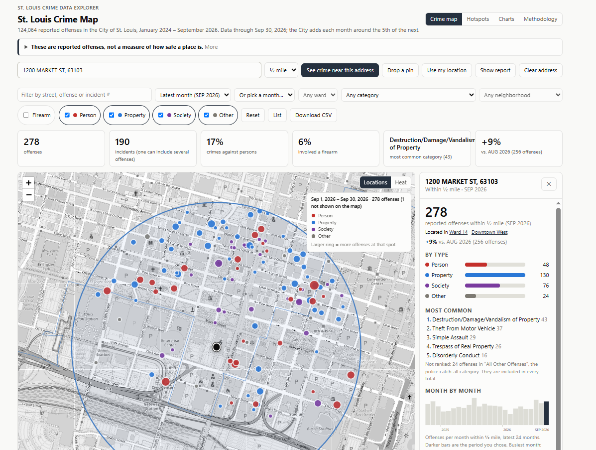
Crime map view: reported offenses within a half mile of a downtown address, with a breakdown by type, the most common offenses, and a month-by-month trend.
Overview
The St. Louis Crime Data Explorer is an interactive web dashboard that maps reported offenses in St. Louis at several spatial scales, from wards and neighborhoods down to a search radius around any address, so people can see the data at the point of need. It is built on monthly data prepared by the geocrime-stl ETL package.
Study Area: City of St. Louis, Missouri
Role: Solo project (design, development, and documentation)
Status: Live
Methods & Tools
Data Source
- SLMPD crime data as posted by the City of St. Louis, typically published around the 5th of the following month.
- Coverage as of October 2026: 124,064 reported offenses from January 2024 through September 2026.
- Offenses are grouped using the NIBRS "crimes against" classification: Person, Property, Society, plus Firearm and Other categories.
Features
- Map views: wards, neighborhoods, individual locations, and a heat layer.
- Address tools: address search, drop-a-pin, and use-my-location, with a "see crime near this address" option.
- Search radius: quarter-mile, half-mile, or one-mile.
- Filters: ward, neighborhood, offense category, and date.
- Analysis pages: Hotspots, Charts, and a Methodology page explaining how the data is prepared.
- Export: download the current list as CSV.
Tools Used
| Tool | Purpose |
|---|---|
| geocrime-stl | Monthly ETL: fetch, clean, standardize, clip to city boundaries |
| City of St. Louis, OpenStreetMap, and U.S. Census geocoders | Address search |
| GitHub Pages | Hosting |
| Agentic, AI-assisted workflows | Used to build and document the dashboard |
Highlights
- Multi-scale view: the same data can be read at the ward, neighborhood, or address-radius level.
- Honest about limits: the site states plainly that these are reported offenses, not a measure of how safe a place is, and notes the limits of the data: block-level locations, per-victim counting, and reporting bias.
- Privacy-minded: pins and device location stay in the browser; typed addresses go only to the geocoding services and are not stored.
The page layout was adapted from a crash-map project by Reddit user u/autosoap, used with permission.